
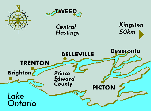
The County of Prince Edward is sometimes referred to as "Quinte's Isle" but locally is affectionately called "The County". Located in the north-east corner of Lake Ontario it is surrounded by water, has a land area of over 125 square miles with some 525 miles of lake shore-line . Formerly a peninsula, the construction of the Murray Canal in 1889 created an island. Access to the Province of Ontario mainland is by 3 highway bridges, one railway bridge and one ferry.
The Geology of "The County"
Almost 13000 years ago the immense mile thick glaciers that held much of the world in an ice coat, receeded from southern Ontario and in doing so, created the land mass we now call Prince
 |
Betty Ann Anderson |
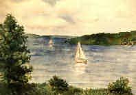
The Sandbanks is an unusual Provincial Park containing two of the finest fresh-water, baymouth, sandbar and coastal sand dune systems in the world. With miles of white sand beaches, the Park is a haven for campers, picnickers, swimmers and wind surfers during the summer months. The Park's nature trails are used year-round.
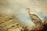
The geology of the balance of "The County" is a conglomerate of varying soil mixtures underlain by mostly sedimentary rock. This rock is close to the surface in some areas and limestone outcroppings and cliffs are to be found. The topsoil varies from sand to loam with a good percentage of farmland. There are a number interior lakes and marches. The variety of terrain, plus the forested areas, and with a light human population; the maintenance of wildlife has been encouraged. The Prince Edward Region Conservation Authority manages a total of 13 conservations areas which are open to the public. This conservation effort is funded jointly by the local municipalities, the Ontario government and private donations.
An equally interesting natural wonder of the "The County" is the Lake-On-The-Mountain, located at Glenora on the east end of an east-west limestone escarpment. The water level of this lake is about 150 feet higher than that of Lake Ontario despite the few feet of horizontal separation between the shoreline of each lake. Very deep over,over 110 feet, this small lake is able to maintain a constant water level.
 |
Betty Ann Anderson |
The People and "The County"
Along the north shore of the "The County" mounds have been found containing skeletal remains which may trace to ancient Mongolian tribes that crossed from Asia to North America, some 7-8000 years ago. The Sandbanks appear to have been a mecca, 300-1000 years ago, for what we now call the Iroquois Indians from the Finger Lakes in New York Sate. The French explorer Samuel Champlain, was the first white person to set foot in "The County" and that was in 1615. He found roaming Huron Indians from the London /Guelph area. The Hurons were killed off by the Iroquois during the Indian War of the 1600's.
The French established a missionary station called "Quinte", for meadow, between Lake Consecon and what is now called Carrying Place, in November 1668. The name soon became Kente but the mission was abandoned for good by the French in 1687. "The County" remained uninhabited for a century. The French believed settlement needed to be discouraged to preserve their lucrative fur trade and in 1759 the English victory at Quebec City ended any French hope of land domination in North America. Until that arrival of the first settlers in the late 1700's, "The County" remained covered with a magnificent primeval forest, filled to capacity with wildlife, and its lakes and inshore waters teeming with fish.
Permanent settlement of "The County" began with the arrival of United Empire Loyalists and disbanded soldiers who had fought on the British side during the American Revolution or the War of Independence 1776-1783. Mostly born in what is the US, the UEL's traced the ancestry to England, Scotland, Germany and Huguenot France. The Loyalists fought against the Patriots to try and remain under the British flag. Having won, the victorious American people confiscated the UEL's property, removed their right to vote, assessed very heavy taxes, humiliated them through tarring and feathering plus prison terms, which sometimes ended in death. Emigration from the US was the only solution and treks northward form the 13 colonies to various parts of what is now Canada ensued; some arriving in "The County" in 1784. These strong UEL settlers succeeded in populating the "The County". The early economy was based on lumbering from the forest stands. Then came the grain growing, with renowned "barley days". In the late 20th century the UEL spirit is kept alive through the efforts of The United Empire Loyalist Association of Canada.
|
For further marvelously interesting details of our local past and present, goto the Town of Picton by the Local Architectural Conservation Advisory Committee.
For more details, please write or e-mail us. We'll be happy to help.